
Boulder is known for steep hikes like Mount Sanitas and Bear Peak, but visitors quickly discover something surprising. You don’t actually need to hike uphill to experience Boulder. In our 25+ years living around Boulder, we’ve explored some of the most beautiful trails, many of which sit on flat ground. Explore Boulder’s prairie trails, lakeside loops, and creek paths right below the foothills. Discover the best Boulder easy hikes and walks with minimal elevation gain. These are ideal if you are:
- acclimating to Boulder’s elevation (5430 ft),
- traveling with kids,
- managing energy or health limitations,
- recovering from a bigger hike,
- or just want a peaceful walk to enjoy the views instead of a workout.
This post may contain affiliate links. If you make a purchase through these links, we will earn a small commission at no additional cost to you. We recommend products we have personally used or verified. Read the full disclosure here.
Don’t have time to read the whole article?
Here is the best Boulder hiking day tour!
Don’t forget to bring along a day pack for hiking, a filtered water bottle, a First aid kit, and trail walking shoes!
Find the top Boulder hotels!
Reserve your car rental today!
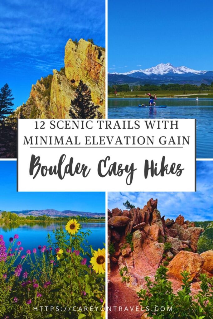
Pin this post for later!
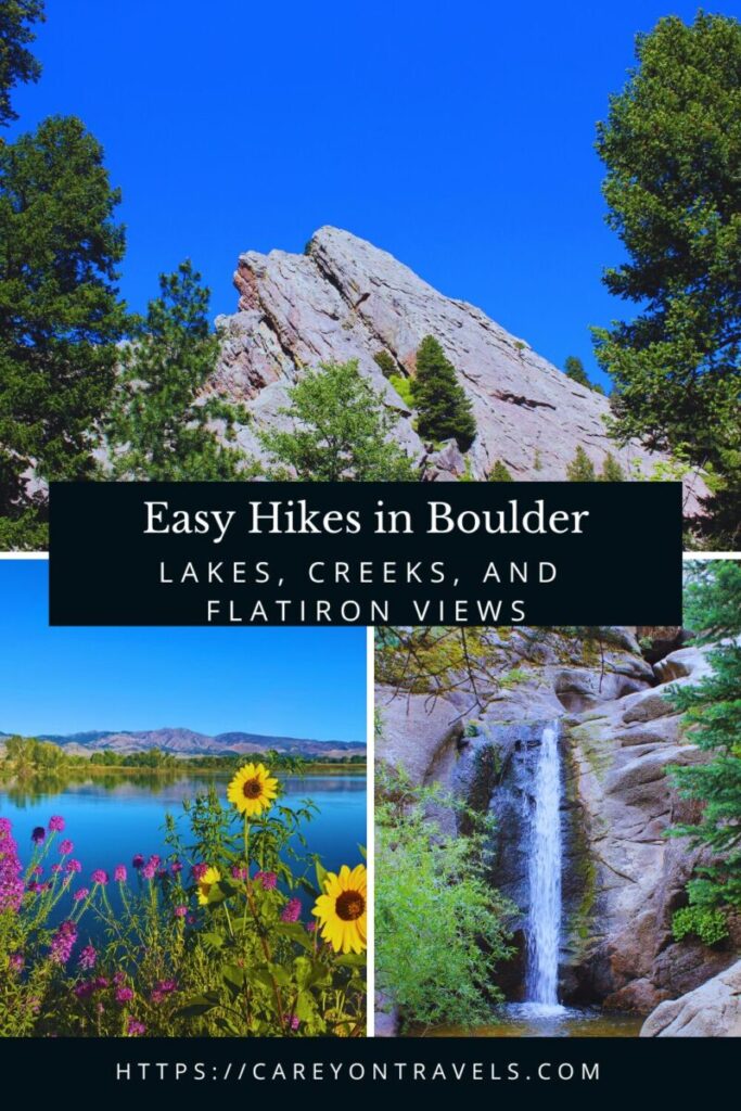
Best Boulder Easy Hikes
Easy Hikes in Boulder (No or Minimal Driving)
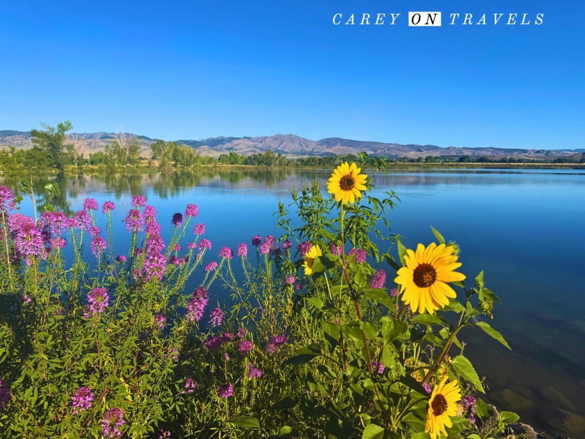
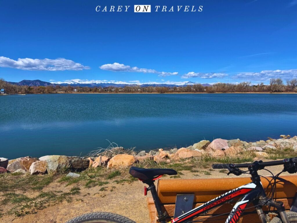
1. Coot Lake Trail
- Distance: 1.3 mi / 2.1 km loop
- Elevation gain: ~30 ft (9 m)
- Pet friendly: Yes (dogs allowed off leash, if in compliance with Boulder’s Voice and Sight program)
- Drive time from downtown Boulder: ~10–12 minutes
- Public transport: Bus to North Boulder + short rideshare/bike (~1.5–2 miles)
- Alltrails link
This is arguably the easiest scenic walk in Boulder and a perfect arrival-day hike. The wide, packed gravel, nearly flat path circles a small lake with uninterrupted views of the Flatirons and foothills. You’ll see herons, pelicans, hawks, and lots of locals out for their daily walk. Excellent sunset light and benches make it a great acclimation walk. It is generally considered handicap-accessible, though this applies to the primary trail around the lake, not the offshoots.
Another off leash dog walk alternative to consider is at CU South , where there are roughly 3 miles of trails with nice flatiron views.
Pro Tip: We enjoy extending this walk by taking one of the trails leading from Coot Lake down to the north side of Boulder Reservoir, or continuing to make a loop around Boulder Reservoir.

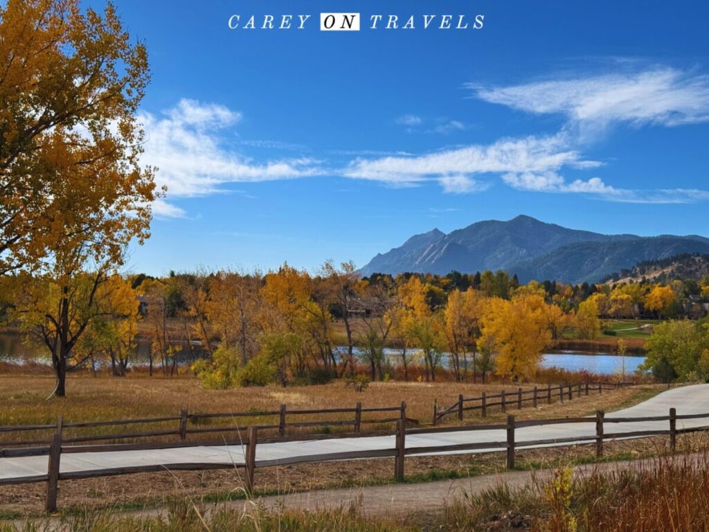
2. Wonderland Lake Loop
- Distance: 2.0 mi / 3.2 km
- Elevation gain: ~90 ft (27 m)
- Pet friendly: Yes (leash required)
- Drive time: 8 minutes
- Public transport: Easily reached via SKIP bus route to North Boulder
- Alltrails link
A classic Boulder neighborhood trail: with lake, prairie, and mountain views all at once. The Flatirons reflect in the water, prairie dogs, deer, and coyote are common, and the trail is stroller-friendly. This is one of the best places to experience “Boulder vibes” without hiking a mountain. This crushed gravel trail is generally considered handicap-accessible.
Pro Tip: Extend your walk by connecting to the Foothills South trail.
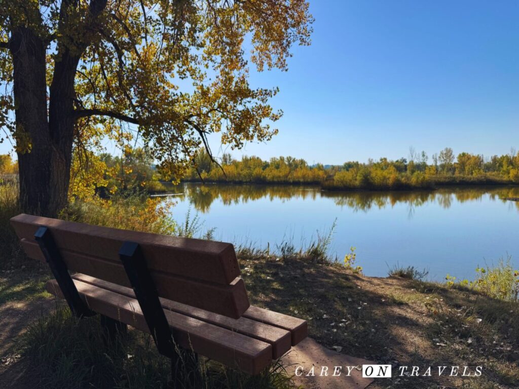
3. Walden Ponds / Sawhill Ponds Wildlife Area
- Distance: 1–3 mi / 1.6–4.8 km (multiple loops)
- Elevation gain: negligible (<20 ft / 6 m)
- Pet friendly: Portions are pet-friendly (on leash), (pets are prohibited in some areas, watch for signs)
- Drive time: 12–15 minutes east of Boulder
- Public transport: Limited — best accessed by car or bike via regional paths
- Alltrails link for Sawmill Ponds
The trails wind through the nature preserve, circling around numerous ponds. These old gravel quarries are now filled with water, creating wetlands full of birds and wildflowers. Expect osprey nests, bald eagles, and migrating waterfowl. Quiet and underrated, you’ll often find photographers here photographing wildlife. There are a number of different loops winding around the area, many of which are handicap accessible.
In winter, we enjoy cross country skiing on the ungroomed trails here when there’s enough snow.
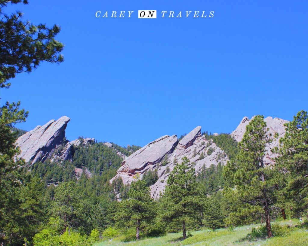
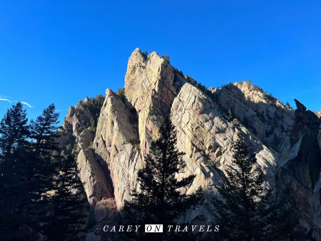
4. Chautauqua Trail
- Distance: 1.3 miles (2.1 km)
- Elevation gain: 430 ft (131 m)
- Pet friendly: Yes (on leash, seasonal restrictions may apply in some areas)
- Drive time: 5 minutes
- Public transport: Frequent free summer shuttle and city bus service
- Alltrails link
Challenging hikes from Chautauqua, such as the Royal Arch Trail and the Flatirons often get the most attention. There are easier hikes to be found though, providing spectacular views of the flatirons. Stay low and start off on the Chautauqua Trail. While it is more moderate, you don’t have to complete the whole out and back to enjoy the views.
Pro Tip: For those ready to challenge themselves a bit more, connect to the Bluebell Loop or Enchanted Mesa.
5. Boy Scout and May’s Point Trail
- Distance: 1 mi / 1.6 km
- Elevation gain: 121 ft (37 m)
- Pet friendly: No
- Drive time: 10 minutes
- Public transport: Take the RTD bus system to downtown Boulder, ride share or taxi is needed to get to the trailhead.
- Alltrails link
The Boy Scout trail is an easy, and quiet trail in the foothills just above Boulder, ending at Sunrise Amphitheater. This connects with the May’s Point Trail, create a shady and easy dirt trail, with lovely views of the mountains to the west and city of Boulder to the east.
Pro Tip: Combine this hike with sunrise at the amphitheater for a spectacular way to start your day.
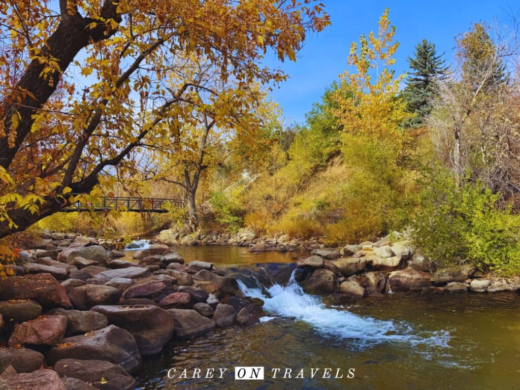
6. Boulder Creek Path
- Distance: 7.6 miles / 12.2 km one way (easy to do just a portion of the trail)
- Elevation gain: 59 ft (18 m)
- Pet friendly: Yes (leashed)
- Drive time: Runs through town
- Public transport: Directly accessible from downtown and multiple bus routes
- Alltrails link
One of Boulder’s best easy walks winds through the city following Boulder Creek through downtown and various parks, and neighborhoods. You’ll be joined by plenty of other walkers, runners, and bikers. Many use this walk to acclimate to the altitude. The majority of the path in town is handicap accessible (the portions in the canyon are less accessible, with some incline and gravel/dirt paths.
One of the best ways to enjoy the Boulder Creek path is to explore the west side of the trail, starting in Boulder downtown or at Eben Fine Park. Head west from here into Boulder Canyon to enjoy the quick transition to a mountain canyon setting.
Pro Tip: On Wednesdays and Saturdays in warmer months, wrap up your walk in downtown Boulder at the farmer’s market. You’ll find incredible local foods, as well as prepared foods and live music.
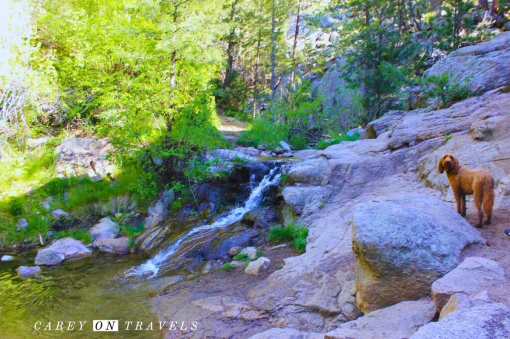
7. Anne U. White Trail
- Distance: 3.2 miles (5.1 km out-and-back)
- Elevation gain: 479 feet (146 meters)
- Pet friendly: Yes (leashed)
- Drive time: 15 minutes
- Public transport: No practical transit access
- Alltrails link
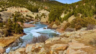
This shady forested trail following a creek in Fourmile Canyon is one of our favorite hot weather trails. It’s best in late spring for wildflowers, in the summer heat, and during fall foliage season. This is a dirt trail with lots of creek crossings and a very gradual incline. It is not ideal for those with mobility issues, due to the uneven terrain,
Bonus: Red Rocks Trail (Moderate)
- Distance: 1.2 mi / 2 km out-and-back (can easily be extended)
- Elevation gain: 377 ft (115 m)
- Pet friendly: Yes (leashed, though check for seasonal closures)
- Drive time: 3–5 minutes from downtown Boulder
- Public transport: Walkable from downtown Boulder (15–20 minutes) or accessible via multiple city bus stops along Pearl Street / Canyon Blvd
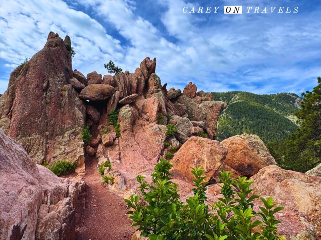
Though this trail is moderate, we wanted to include an option that would take you to Boulder’s beautiful red rocks. Located right above downtown, this is a perfect “step-up” from a flat walk — still approachable but more like a true hike. The trail climbs gradually to striking red sandstone formations and panoramic views over Boulder and the plains. You’ll get a similar feel to some of Denver’s best Red Rock Trails (at a smaller scale), but without the crowds or long drive. It’s especially beautiful at sunrise and golden hour and works well if you want a short hike before dinner in town.
If the other hikes in this guide are walks, this is your first real foothills hike — a great transition after acclimating at Coot Lake or Boulder Creek Path.
For more of a challenge, consider extending this by doing the Red Rocks Anemone Loop.
Easy Hikes Near Boulder (10–35 Minutes Away)
8. Waneka Lake Trail (Lafayette)
- Distance: 1.2 mi / 2 km loop
- Elevation gain: ~20 ft (6 m)
- Pet friendly: Yes (leashed)
- Drive time: 15–18 minutes
- Public transport: Regional bus to Lafayette + short walk
- Alltrails link
For those looking for another lakefront loop in Boulder county, try Waneka Lake, a flat, open trail with wide Front Range mountain views. It's an excellent sunrise and sunset walk and easier than most Boulder trails. It's also a great spot for birding, combined with neighboring Greenlee Wildlife Preserve (on the northwest side of Waneka Lake). This crushed gravel trail is considered handicap accessible (staying on the main trail around the lake).
Pro Tip: To extend this walk, take the neighborhood trails to connect to Hecla Lake or to the much longer Coal Creek Trail.
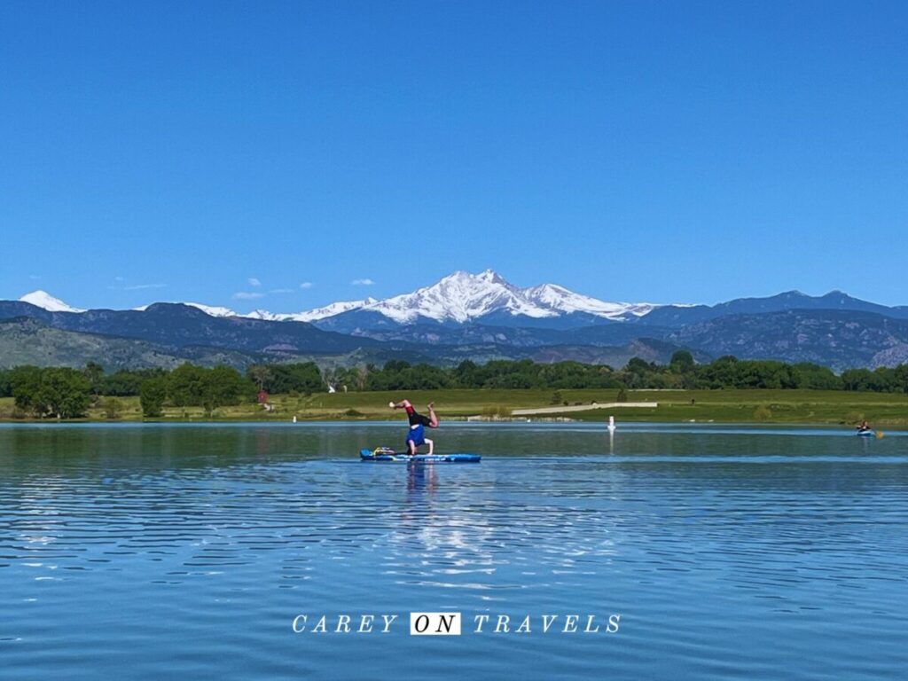
9. McIntosh Lake Trail (Longmont)
- Distance: 3.5 mi / 5.6 km loop
- Elevation gain: 36 ft (11 m)
- Pet friendly: Yes (leashed)
- Drive time: 25 minutes
- Public transport: Bus to Longmont + rideshare recommended
- Alltrails link
McIntosh Lake has one of the best skyline views on the Front Range, whether you are walking around the lake or are enjoying a paddle on the lake. On clear days you can see Longs Peak. This is a wide gravel path, paved in parts and is very flat and considered handicap-accessible.
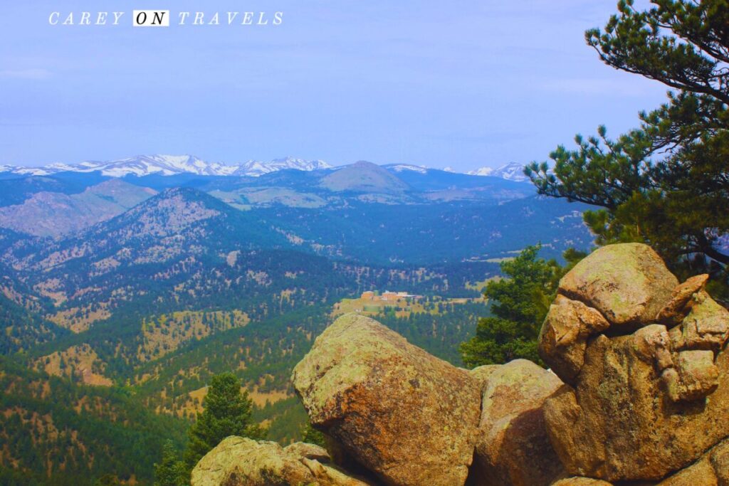
10. Fowler Trail — Eldorado Canyon State Park
- Distance: 4 mi / 6.4 km out-and-back
- Elevation gain: ~200 ft (60 m) gradual
- Pet friendly: Dogs are allowed (on leash), though they are not allowed on the connecting Goshawk Ridge Trail
- Drive time: 15 minutes
- Public transport: None
Alltrails link
Possibly one of the best easy scenic hike near Boulder, that we enjoy nearly year-round. The trail follows an old rail grade along a canyon wall. Hikers enjoy dramatic cliffs and huge mountain views — but minimal effort. This always feels like one of the easiest and closest trails where you quickly feel like you are in the mountains.
Pro Tip: Continue on to Rattlesnake Gulch trail for a more challenging and longer hike.
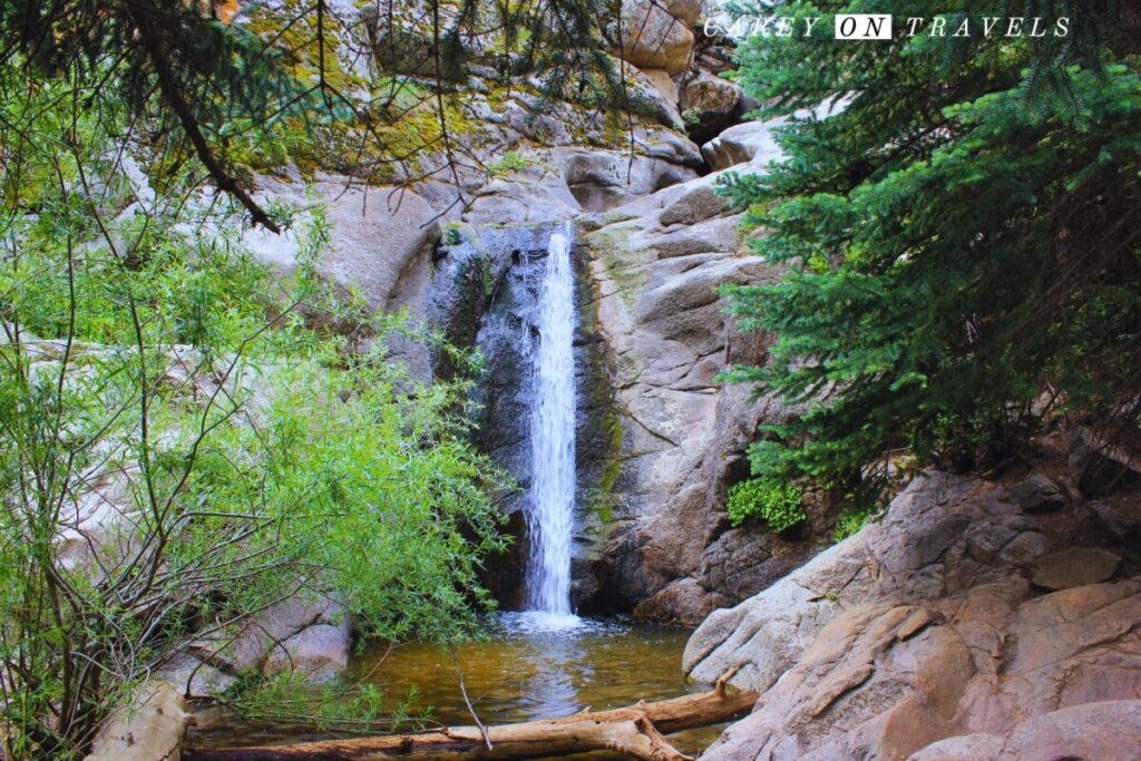
11. Forsythe Canyon → Gross Reservoir
- Distance: 2.9 mi / 4.7 km options
- Elevation gain: 400 ft (121 m) gradual
- Pet friendly: Yes (on leash)
- Drive time: 30-40 minutes
- Public transport: None
- Alltrails link
From the trailhead, this forested trail leads gently downhill along a stream, leading to Gross Reservoir. While it is considered easy, the footing is uneven in parts, and there is a short stretch near the waterfall with steeper rolling hills. You can turn around before the hills, though you won't make it to Gross Reservoir in that case. This is ideal in summer, when you're looking to get out of the heat of the city.
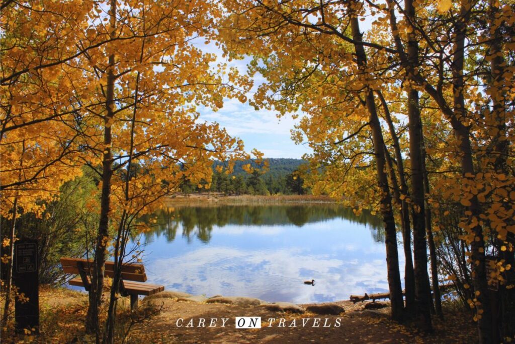
12. Mud Lake (Nederland Area)
- Distance: 0.6 mi / 1 km (with additional loops available)
- Elevation gain: <50 ft (15 m)
- Pet friendly: Yes (leashed)
- Drive time: 30–35 minutes
- Public transport: Limited — seasonal Nederland bus + taxi/rideshare
Alltrails link
A quick drive from Boulder, Mud Lake is the perfect spot to find cooler mountain air, forest shade, and short loops around small lakes. Excellent easy hike on hot summer days and for stunning fall foliage.
Pro Tip: If you are not hiking with a dog, consider connecting this to the moderate trails at neighboring Caribou Ranch.
Suggested Easy-Hike Ideas
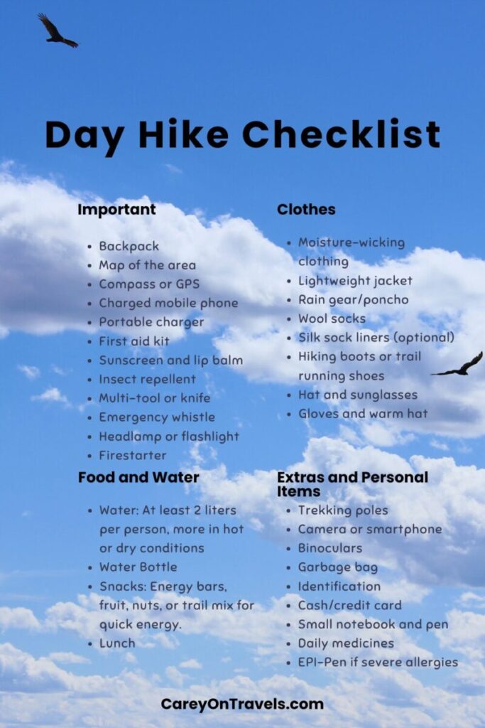
Be sure to prepare for your day hikes before heading out on the trails.
Arrival day: Coot Lake, Boulder Creek Path, or Wonderland Lake
Flatiron views: Chautauqua Trails
Hot weather: Anne White, Forsythe Canyon, or Mud Lake
Best scenery with little effort: Fowler Trail
Quiet nature: Walden/Sawmill Ponds
Sunset walk: Waneka Lake
Final Thoughts on the Best Easy Hikes in Boulder
Boulder’s reputation is built on challenging outdoor activities. But its real magic is accessibility. You can stand on an easy trail, look up, and enjoy the stunning mountain views.
As locals, we enjoy these trails frequently for our dog walks — because the Flatirons look just as good from the bottom.
Boulder Area Planning Resources
- Best Unique Places to Stay in Boulder, Colorado
- Best Time to Visit Boulder, Colorado
- How to Spend 24 Hours in Boulder, Colorado
- Fall in Colorado, a Local's Guide to Autumn Color
- Best Things to Do on a Rainy Day in Boulder
- Local's Guide to Boulder, Colorado's Top Family-Friendly Tours
- Boulder vs Fort Collins, Which Colorado Town Should You Visit?
- Essential Day Hike Checklist
If you enjoyed this post, pin it for later!
Travel Resources
We recommend booking through our preferred travel booking sites below.
| Air Travel | SkyScanner |
| Lodging | Booking.com, VRBO.com, Expedia.com, Hostelworld |
| Tours and Activities | Viator.com, GetYourGuide.com, TakeWalks.com, Tinggly.com |
| Car rentals | Discovercars.com |
| Travel insurance | Squaremouth |
| Bike and scooter rentals | BikeBookings.com |
| Train tickets | RailEurope |
| Bus tickets | Busbud |
Leave a reply